Feather Falls Trip
I had been wanting to take a hike to Feather Falls for several years. For the longest time, I had waited, hoping to put together a group that could include one or another girl that I could get to know better. But it never worked out, so I decided that I would just do it this year, company or no, rain or shine.
Feather Falls is in Plumas National Forest, near Lake Oroville, north of Sacramento. It's about a 3.5 hour drive from Reno, so I left early with an old friend of mine who came with me, despite the less than sunny weather.

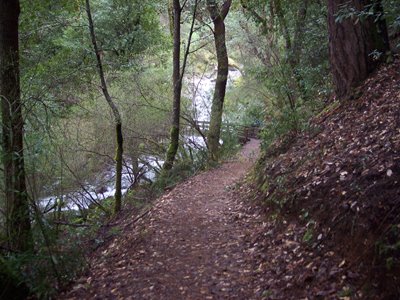
The trail is well-maintained, with pit restrooms and paved parking at the trailhead. There is a map of the area, which gives some sense of the area around the falls. As the 6th highest waterfall in the United States, the 9 mile hike isn't as much of a deterrent as it could be.

Early on in the hike, I stopped about every 50-100 steps to take a picture. I had put off coming for so long, I was determined to record the trip. There were many interesting looking trees, rocks, and other things near the path initially.

There were also various forms of cold-blooded wildlife. Specifically, red geckos and yellow slugs. I did not get any pictures of the slugs, but they were about 3 inches long, two inches in circumfence, and... slugs.

The trail was great. After seeing various small streams giving seasonal waterfalls about, we approached Frey Creek. This waterfall was audible about a quarter mile away, and grew quite loud as we approached. I took a video of walking up to the falls, but don't have a convinient way to share it, so you get the picture instead.
There were several bridges, and other points at which streams were sent under the trail in pipes. But once in a while, we got to "ford the river," as it were. Matt told me he'd get an action shot of me jumping across one. It's best he didn't - I'm sure that it was a less than pretty sight.

This would be a view of Blad Rock Dome, which I think I read somewhere was worshiped by the Native Americans. But, it was cloudy. That was a bit of a shame, and had me wondering what, if any, view of the falls I would get.

After roughly 5 miles on the trail, we went sharply up the side of a hill, with an ominous rumble growing in the background. This was a steep hill, and it took a few breathing stops to get up. But there it was: benches, railings, and an overlook! We approached, only to find that the overlook was not for the falls, but for the river. It was, nevertheless, a good view. We got to chat with some other hikers on the trail, had our picture taken, and did other such things. But you don't get to see those pictures - they didn;t turn out as good as I had hoped.

Continuing on the trail, it narrowed sharply, and the rumble in the background continued to grow. Finally, we spotted the hikers ahead stopping and pulling out their cameras. Our treat was our first glimpse of the falls.

We continued down a couple sets of switchbacks, getting glimpses of the falls as we descended, but not toward the falls - that trail branched off over rocks slick with rain, and as my friend and I had very vivid memories associated with hiking over wet rocks in this general vicinity, we decided against that route. We finally came upon a well-maintained overlook, offering a view of the full drop of the falls.

After lunch, we climbed the stairs off of the overlook, beginning the hike back. We had taken the long (newer) trail on the way in, and took the shorter, older and (AS we learned) steeper trail on the way out.

I took few pictures on the way out. Mostly, I was just tired. I'd have sat longer at the overlook, but I was under a clever lean-to using my umbrella. Matt, unfortunately, was sitting exposed to the wind and rain. I did get this picture of some interesting-colored trees. I don't know what they are.

Frey Creek acted as the marker bisecting each leg of the trail. Lower Frey Creek had no falls on the scale of those above, but was a nice stream that we didn't rest beside nearly long enough. From the bridge where I took this, the final mile and a half is all uphill.

How far is the hike? I took this on the way in. I was glad to see it on the way back. Add about a half mile, roughly, on each side of this sign and its companion near the falls, and you;ll have an idea. Elevation gain: roughly 2,500 feet.

The way to Feather Falls, or in this case from the falls, is 11.4 miles of twisting, winding, up-and-down craziness. It began our 3.5 hour trek back to Reno. Biggest mistake? Not sitting down and stretching out my legs before hopping in the car to go back. When Matt and I got out to put some gas in the car about halfway through the return journey, I thought my legs had turned into stone. The very limited motion of clutch, brake, gas didn't do much to keep me limber.

All told, I'd go back. I'm glad I went, despite not having a female companion to do so with. I have spent too much time waiting for someone to do things with, and have not spent enough time just doing them. I'm trying to change that. This was a good step in that direction.
posted by -Dave @ 9:31 PM
1 comments
![]()
![]()

1 Comments:
some GREAT pictures there!!! i loved the 3rd one of that huge, beautiful tree, and i think it was the 13th one, of the river... THAT one looks JUST like the pigeon river in tennessee/north carolina. yep, i'm homesick now. :)
i came to a similar conclusion when i lived in tennessee about not waiting around for people, only the person i got tired of waiting on was a girl, a good friend of mine, my normal hiking companion. but we went through spells where she was always busy, and during my last few months in tennessee i decided i wasn't waiting around anymore. so i went on two solo hikes at my favorite spots, carver gap at roan mountain & massey gap at mt. rogers (both stretches of the appalchian trail). kind of scary & exciting all at once, going hiking alone. (and my mom wasn't too happy when she found out, lol) i loved it, though... i miss my appalachian trail.
Post a Comment
<< Home